Laser and Topographical Survey For Extension
Refurbishment and extension for a historic home in Tyler Hill, Canterbury.

Family Home Extension
Pro Point were instructed by our client to assist with the extension and refurbishment plans for their beautiful site located on Calais Hill, just south of the Tyler Hill region, approximately two miles north of Canterbury City Centre. The property, which has been a cherished family home passed through multiple generations, is situated in a scenic and peaceful location, accessed via a private track and set back from the main road. It falls within the Tyler Hill Conservation Area, adding an additional layer of sensitivity to the planning and design process.
Given the historical significance and beauty of the locally listed building, Pro Point was tasked with ensuring that the architectural team had the most accurate and reliable information to create a sympathetic extension that blends seamlessly with the original property.
Our role involved conducting a comprehensive measured survey using state-of-the-art 3D laser scanning technology to gather precise measurements of the existing structure. These 3D scanners allowed us to generate highly accurate digital representations of the building, enabling the architectural team to work from precise data while designing the new extension. This technology ensures that no detail, no matter how small, is overlooked, especially important for a property in a conservation area.
In addition, we carried out a topographical survey of the site, employing specialist equipment to measure and map the natural and man-made features of the land. This survey provided crucial information on the land's contours, boundaries, and existing features such as trees, outbuildings, and pathways, ensuring that the extension’s design would complement and respect the natural environment. The topographical data was delivered to the architectural team to assist with planning the extension and its integration into the landscape.

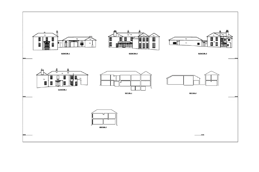
The final deliverables included:
- Detailed Floor Plans: Representing the existing building layout as well as proposed changes for the extension.
- Sections: Showing vertical cross-sections of the building to help visualise the relationship between the new and old elements.
- 2D CAD Drawings: Accurate, technical representations of the building and site, essential for the planning application process and the subsequent construction stages.


By providing these detailed surveys and technical drawings, Pro Point played a key role in supporting the architectural team’s design process and ensuring that the project could move forward with a clear understanding of the site’s unique characteristics and constraints.

Measured Survey For Listed Building

Detailed Surveys For Listed Building Conversion
Quickly and easily create a quote for your project.

Start with a few details and we'll put together a quote for you.